Statewide :: News & Press :: Interactive Map :: Map Poster :: About the Map :: Landsat Lake Images
| What
Lake Clarity Means |
||
| What "Clarity" Means The clarity of lake water, or its transparency, is often related to the amount of nutrients in the water. Nutrients promote growth of plankton and algae. The more nutrients, the more plankton and algae, and the cloudier the water is. Why Clarity Matters In most cases, the clearer a lake is, the healthier it is. Human activities impact the quality of lakes and wetlands in many ways. Eutrophication is the most pervasive problem affecting lakes. While eutrophication itself is a slow, natural process, it is greatly accelerated when excessive nitrogen, phosphorus, and other nutrients runoff from agricultural landscapes, fertilized urban lawns, golf |
courses, or streets, when septic systems are defective, or when urban storm drains enter lakes. As lakes become eutrophic, their recreational and ecological quality declines. When Clarity is Not a Good Indicator Some lakes (particularly in the northern part of the state) have naturally occurring high levels of colored dissolved organic matter, tannic acid, and humic acid that can stain the water a dark brown color. These lakes may be in perfect “health” but also have a low level of clarity. The satellite assessment of water clarity shown in this map provides a reliable estimate of water clarity, but determining whether or not any given lake is suffering from degraded water quality requires additional information. |
|
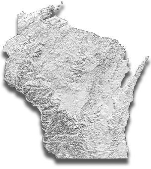 Shaded Relief Base Layer Researchers created this shaded relief map from USGS digital elevation data. The map was constructed with layers in a GIS (Geographical Information System). It includes layers for lakes, towns, and major roads, superimposed on the shaded relief map. |
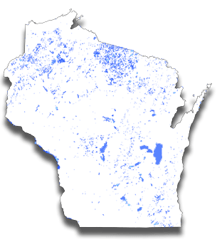 Lake Polygon Layer The Wisconsin DNR provided the lake polygon layer used to "clip-out" lakes from the satellite imagery. The information from the satellite was then calibrated with "ground-truth" information collected for about 10% of the lakes. A set of regression models were used to extroplate clarity values for the remaining 90%. |
|
How this Map was Made |
||
| How
Clarity is Measured People traditionally measure lake water clarity with a “Secchi” disk, named after its inventor, Father Angelo Secchi, a 19th century Italian Jesuit priest and Papal scientist. A Secchi disk is a 20-centimeter (8-inch) diameter metal disk, usually painted black and white, that a researcher or lake monitoring volunteer lowers over the side of a boat with a rope at the deepest part of a lake. By using the rope as a measuring tape, the person notes the depth at which the disk is no longer visible. The clearer the lake, the deeper the Secchi measurement will be. The Wisconsin Department of Natural Resources coordinates annual summer Secchi measurements through a network of volunteers called the Self-Help Citizen’s Lake Monitoring Program. This information is extremely valuable for monitoring lake water clarity. However, Secchi measurements are only collected for approximately 800, or 10%, of the large lakes. Using new satellite remote sensing technology, the clarity of the remaining 90% of the large lakes can be accurately estimated. How Satellite Imagery is Used For this map, researchers at the University of Wisconsin’s Environmental Remote Sensing Center derived the clarity estimates from a mosaic of satellite images collected by the Landsat-5 and -7 satellites over three summers (1999-2001). Three summers were necessary due to the limitations imposed by the satellite’s orbit and cloud cover. The Landsat satellites orbit the Earth at an altitude of 705 kilometers (438 miles) above the surface, passing over the same point once every 16 days. However, Wisconsin’s humid |
summer climate limits the number of cloud-free images available. To ensure consistency from year to year, researchers only use images collected between mid-July and mid-September. This is the period when Wisconsin’s lakes are used most intensively, and when water quality problems (such as algal blooms) are most likely to occur. The map is simply a composite “snapshot” in time, since the clarity of any given lake can change substantially over time. To “calibrate” or “ground-truth” the satellite images, volunteers in the Self-Help Citizen’s Lake Monitoring Program made water clarity (Secchi disk) measurements on hundreds of lakes, timed to coincide with the satellites’ orbits over Wisconsin. The resulting database represented by this map is the most complete and up-to-date record of the clarity of Wisconsin’s lakes available. Why Some Lakes are not Mapped Lakes under 2 hectares (5 acres) in area are not included in this database, because such small lakes do not generally completely cover many Landsat image pixels. Even lakes greater than 2 hectares may be omitted if their shape is narrow or highly irregular, such that no 30-meter Landsat pixel falls entirely within the lake’s boundary. Finally, the water clarity estimates for very shallow lakes are unreliable, because the spectral radiance measured by Landsat may be coming from the lake bottom, rather than from the water itself. Thus, lakes that are known to be “optically shallow” (having a maximum depth that is less than twice the normal Secchi disk measurement), or whose depth is unknown and presumed shallow, are noted in the database. |
|